Lowrance HDS-9 Gen3 with 83/200 Transom Mount Transducer and StructureScan 3D Module w/ Transom Moun
Ships: In 1 Business Day
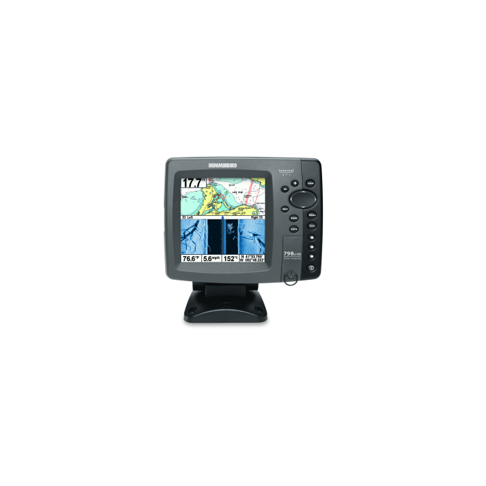
HDS-9 Gen3 Fishfinder/Chartplotter High Definition System that integrates leading-edge fishfinder technologies and the latest advances in navigation into one easy-to-use, multi-touch display.
Lowrance High Definition System (HDS) combines a brighter, multi-touch display and enhanced processor with leading-edge fishfinder technologies -- including CHIRP Sonar, Broadband Soundertm, StructureScanr HD, DownScan Imagingtm and Trackbacktm view -- plus the latest advances in navigation and user interface -- including internal 10Hz GPS, dual microSD-card slots, touch-plus-keypad operation and built-in wireless connectivity -- all in one easy-to-use display.
Features
- Easy To See: 9-inch, LED-backlit, multi-touch, widescreen display
- Simple To Use: Improved Lowrance interface with touchscreen or keypad option provides lightning-fast, fingertip access to all HDS features.
- Most Advanced Fishfinder Technology: View CHIRP Sonar and StructureScanr HD at the same time to get the best possible view of fish and structure, both below and to the side of your boat
- Quickly Make Adjustments: With an enhanced, faster processor and intuitive user-interface features -- including scrolling menus, cursor assist, snap-to setting markers and innovative preview panes with quick-touch slider bars.
- Stay Connected: Integrated wireless connectivity with the Lowrance GoFree App and other onboard devices - view and control select HDS Gen3 displays wirelessly using supported tablets and smartphones.
- More Is Better: Plug-and-play compatibility with Lowrance performance modules -- Broadband Radar, SonicHub Marine Audio, SiriusXMr Marine Weather and audio, Class B AIS and DSC VHF -- as well as industry-leading technologies, such as SmartSteer control for MotorGuide PinpointGPS and the Lowrance Outboard Pilot.
- Connects and communicates with HDS Gen2 Touch and HDS Gen2 multifunction displays
- Dual Ethernet networking ports
- Micro-C connection for NMEA 2000r devices
- Video input via optional adapter cable
- Same flush-mount cutout and bracket as HDS-9 Gen2 Touch
Navigation advantages
- Internal GPS antenna - with 10Hz position update rate provides ultra-accurate trails, smoother chart performance and maximum position accuracy. Supports WAAS/EGNOS/MSAS corrections.
- Extensive mapping options - HDS Gen3 includes built-in Insight USA charts for Coastal and Inland US waters and a world background reference map, and is compatible with the most expansive selection of cartography on the market. Options include Insighttm HD, Insighttm PRO, Insight Genesistm, Navionicsr, C-MAP MAX-N+, Insighttm TOPO and more. All charting options can be used with Insight Plannertm PC planning software. Visit the GoFreeMarine.com for more details.
- Insight Genesistm personalized maps - Make your own maps using recorded sonar logs, upload data to Insight Genesis account, view secure custom chart detail online, add optional vegetation or bottom-hardness overlays, download to an SD card and use on the water. Plus, you now have the option to share maps with the Insight Genesis Social Map community.
- Multi-view and chart sharing - View two charts simultaneously, in 2D or 3D perspective view, with independent control, range and overlay capabilities. Plus, get the maximum from your chart card purchases; buy one map card and view it on all Ethernet networked HDS Gen3, HDS Gen2 or Gen2 Touch chartplotter displays.
- Dual microSD card slots
Sonar Advantages
- Built-in CHIRP Sonar - Dominate with greater sensitivity, improved target resolution and superior noise rejection for clearer, easy-to-see bait fish and game fish targets. Delivers multiple CHIRP and Broadband Sounder frequencies from a single transducer(Chirp Transducer regquired).
- Built-in StructureScanr HD sonar imaging - Enjoy picture-like 180-degree views of structure and fish below your boat. Requires optional StructureScanr HD transducer.
- Built-in, award-winning Broadband Soundertm - Display and mark gamefish, baitfish and structure at higher speeds and at greater depths - from 1 to over 3,000* feet.
- StructureMaptm HD capability - Use live or recorded StructureScanr HD logs to create stunning underwater images of lakes, rivers or seafloor. StructureMap can be viewed as an overlay, and toggled on and off to provide the ultimate in situational awareness in relation to both chart and bottom detail.
- DownScan Overlaytm technology overlays DownScan Imaging onto CHIRP Sonar or BroadBand Sounder.
- TrackBacktm to review and save key hotspots - Scroll-back thru sonar or StructureScanr HD imaging history to review structure or fish targets and pinpoint the location with a waypoint.
- SpotlightScantm Sonar ready - optional add-on delivers a new level of angler-controlled surround-scanning view to provide picture-like images of key fishing areas.
Specifications
Sonar
- Comes with HST-WSBL 83/200 khz Transom Mount Transducer
- Depth Alarm: Yes
- Output Power: 500W RMS StructureScanr HD and CHIRP/Broadband
- Sonar Frequencies: 455/800 kHz (StructureScanr HD), 40-60kHz, 85-145kHz, 130-210kHz (CHIRP), 50 kHz/83kHz/200kHz (Narrow Band)
- Max Side-Scanning Range: 300 feet per side
- Shallow Alarm: Yes
- Temperature Readings: Yes
- Transducer Type: Multiple selections Lowrance and Airmarr
- Max Depth Per Sonar Operation: StructureScanr HD : 300' / 91M at 455/800 KHz CHIRP: 3500' / 1067M (transducer dependent)
Technical/Environmental
- Display: 9/ 229mm (16:9) Widescreen
- Product Width: 10.43 \ 265mm
- Product Depth: 3.39 \ 86mm
- Product Height: 6.65 \ 169mm
- Resolution: WXGA color TFT LCD 800 x 480
- Backlighting: LED With Adjustable Display and Keypad
- Power Output: RMS (PTP): Max 500W RMS
- Operating Voltage: 12V DC (10-17V DC min-max)
- Waterproof Standard/Rating: IPx7
- Warranty: Two year
GPS Navigation
- Navigation: Routes: 200
- Navigation: Waypoint Storage: 5,000
- GPS Antenna Type: Internal 10Hz ultra-high-sensitivity WAAS + EGNOS + MSAS (optional external antenna)
- Plot Trails: Up to 100 trails - up to 10,000 points / trail
- GPS Alarms: Yes
- Background Mapping: Built-in Insight for US waters and world reference background map
- Mapping Options: Insight Genesis, Lake Insighttm and Nautic Insighttm PRO and HD, Insighttm TOPO, Navionicsr+, Navionics Platinum+, Gold and HotMapsr Premium, Fishing Hotspotsr PRO and Jeppessen C-MAP MAX-N+
Networking Connectors
- NMEA Output: NMEA 0183 and NMEA 2000r
- Power and Video: Red 10-pin power connector
- Transducer Port 1: Blue 7-pin connector for Broadband and CHIRP sonar
- Transducer Port 2: Black 9-pin connector for use with StructureScanr HD and SpotlightScantm transducers
- Yellow Ethernet Port
- Wireless Connectivity
StructureScanr 3D SideScan Imaging for HDS Gen3, NSS evo2 and N
SO evo2
Powered by multi-beam sonar technology, StructureScan 3D produces images of underwater terrain and targets in stunning, high-resolution, 180°, 3-dimensional views.
StructureScan 3D sidescan imaging reveals underwater terrain and fish-holding structure to create a super-wide, 180°, 3-dimensional view beneath your boat. The exclusive 3-dimensional views can only be displayed on the Lowrance HDS Gen3 fishfinder/chartplotters, Simrad NSS evo2 and NSO evo2 navigational systems. This unique, true-to-life view is attained with a single SKU that includes a SideScan 3D Skimmerr transducer and StructureScanr 3D module.
Features:
- Easy-to-Understand Sonar Images-Leading Edgetm scanning reference provides clear graphical illustration of sonar beams
- ScanTracktm allows viewing of 3D images from any angle with pan-tilt-rotate control
- Increased SideScan Range and Unrivaled Clarity-Scan up to 600 feet to each side of the boat with incredibly detailed, high-definition views
- Easily understand where fish and fish-holding structure are located
- Easily identify vertical drops and crucial depth changes
- Use 3D Waypoint Overlay makes it easy to revisit fishing areas, structure, and other underwater features
- SelectScantm Target Identification-Automatically shades fishholding cover and suspended targets in a contrasting color, making target identification quicker and easier than ever before
StructureScan 3D Advantages:
3-Dimensional Views, Improved DownScan Imagingtm and StructureScanr HD
Contours below the water's surface are shown - up to 600 feet port and starboard - with incredibly detailed, high-definition views. StructureScanr 3D provides multiple views, including 2-dimensional DownScan Imagingtm and StructureScanr HD, and the realistic 3-dimensional views.
Clearest Possible SideScan Views
The StructureScan 3D transducer design has been enhanced with an increased number of sensors for greater imaging performance.
Complete Control Of Underwater Views
Using preset virtual point-of-view angles or ScanTracktm pan-tilt-rotate control mode, you can adjust the view and perspective beneath your boat. Combine custom HD and 3D views to increase your understanding of how fish relate to cover and to search fishing areas more effectively.
The Leading Edgetm Scanning Reference Instantly Shows Coverage Area
Leading Edge provides a graphical illustration of sonar beams as they intersect with bottom contours. The most recently scanned area is represented by red fan-shaped markers directly under the boat. Leading Edge also includes a depth scale that shows greater depth detail as you zoom in, giving you a better sense of target depth.
SelectScantm Target Identification Makes Fish Detection Easier
Automatically shades fish-holding cover and suspended targets in a color that contrasts the selected color palette, making target identification quicker and easier than ever before.
Vertical Enhancement Makes Even The Slightest Depth Changes More Visible
This feature is a user-selectable scale that applies onscreen emphasis to vertical drops and crucial depth contour changes, making them easier to identify relative to the surrounding underwater terrain.
3D Waypoint Overlay Creates A Virtual Buoy Marker
Revisiting fishing areas, structure and other underwater features is easy with the Waypoint Overlay feature. Use the waypoint keypad to save a waypoint at the boat location, or switch to cursor mode, and save a waypoint over specific targets, baitfish or cover.
Extra Ethernet Expansion
The StructureScan 3D module supports connectivity For up to 3 networked devices.
Please be aware that all products have a production or warehouse lead time. This is the number of business days (typically not including the day the product was ordered) that must pass before the item begins the shipping process. Please see the "Ships: In" information located within the main product description to the right of the product image and below the ADD TO CART button for that particular product's "Ships: In" timeframe.
IMPORTANT: Please note that these timeframes are estimates only based on the latest information provided to us by the manufacturer/supplier. Delays in both material, production and shipping timeframes by manufacturers can vary without advanced notice and while we do our best to keep "Ships: In" timeframes up to date we may not always be able to do so due to a variety of factors.
If a product is needed by a specific date we strongly recommend you reach out to our Sales team (1-800-869-1686) to verify shipping timeframes.
Canadian orders please add an additional 14 business days for processing and shipping. Alaska and Hawaii orders please add 1 additional warehouse processing day.
Click here to see our Standard Shipping Policy
 WARNING: Cancer and Reproductive Harm - www.P65Warnings.ca.gov.