New Guy / Information

sholum97

Recruit
Joined
Jul 13, 2017
Messages
4
I'm looking for a bit of help. I just purchased a new Harris 22' pontoon with a 115hp Merc for crusing. The pontoon is slipped on the Mississippi River in the LaCrosse, Wisconsin area. For those of you that are unfamiliar with the upper Mississippi, there are an awful lot of underwater obstructions known as wing dams in the area. They are basically piles of cement/rock that are randomly placed just under the water for the purpose of pushing water towards the main channel. You're fine if you stay in the main channel but are rolling the dice if you venture off of it unless you know the river well.

To my question... Are there products out there that will show me the underwater obstructions while I am boating? I'm looking for an electronic screen that will basically tell me that a wing dam is 20' or whatever in front of me off to the left if that makes any sense. I don't fish and am unfamiliar with the technology out there. Do I need a GPS? Fish finder? Chart plotter? Something else??

Thanks for any help you can offer...
 

H20Rat

Vice Admiral
Joined
Mar 8, 2009
Messages
5,204
Short answer, NO. Assuming there is a perfectly accurate topo map including the obstructions (highly unlikely), GPS accuracy is often off by 20 feet or more. And fishfinders/depthfinders tell you what is under you, not in front.

You have it easy! Wing dams don't move. I boat on the missouri and have constantly moving sandbars. Could be 10 feet deep one day and 6 inches a week or 2 later.


It comes down to experience. If the wing dam is shallow enough to hit it, you should be able to detect it via the surface of the water. It takes a lot of practice and skill, but given some time, it shouldn't be too hard. Watch for changes in the surface that just don't belong there. Sometimes a little ripple, maybe an eddy. Subtle color changes are also a big indicator.
 
Last edited:

EchoNovember

Petty Officer 1st Class
Joined
May 25, 2017
Messages
315
Humminbird Smartcast RF35 or something else from the Smartcast series.

https://www.walmart.com/ip/Humminbird-Smartcast-Rf-35-Wrst-Snr/3932878

It's still rolling the dice, but it can help give you some sort of idea. I'd hate to spend my day casting and retrieving a sonar just to see if I can venture out of the main channel, though, and it's still not a guaranteed way to find every single one of them.

I would go with smokingcrater, though, learn how to read the water ripples and surface disturbances. I did that while kayaking on a river in Kentucky when I was a teen and avoided all partially submerged rocks that others in my group kept bouncing off of. Experience is going to be a big part of it.

Something like this could help if you can find them. If I was boating on the river, I'd want extra protection myself.
http://www.iboats.com/Toon-Tectors-trade-Pontoon-Log-Keel-Protectors/dm/view_id.39176

Good luck and I hope you can avoid all of the wing dams! When in doubt, GO SLOW. A lower speed impact does significantly less damage than one at WOT.
 

JASinIL2006

Vice Admiral
Joined
Feb 10, 2012
Messages
5,738
I boat on the Mississippi south of you, near Keokuk, IA. I bought the Garmin maps (LakeVu or Lake Master, I forget which) for my Humminbird. It shows the location of wingdams as part of the charts. Very useful; I nicked a wing dam when I first gotmy oat, and it did a number on my prop.

The location of wingdams and other features is quite accurate, if tou have a GPS eabled devive.
 

Scott Danforth

Grumpy Vintage Moderator still playing with boats
Staff member
Joined
Jul 23, 2011
Messages
51,524
a really good GPS sounder with lakevu, forward and side-sonar

wing dams are charted
 

Silvertip

Supreme Mariner
Joined
Sep 22, 2003
Messages
28,771
There is a simple way ti avoid wing dams. The Mississippi id a navigable waterway and as such has channel marker bouys. Stay between the red and green bouys and you are guaranteed nine feet of water. Venture outside the bouys and you are in dangerous water. At 20 mph any warning device will tell you of the obstruction a second before you hit it.
 

JASinIL2006

Vice Admiral
Joined
Feb 10, 2012
Messages
5,738
The nice thing about the charts with wingdams marked is that it helps find spots that are safe for beaching on the shore. Some areas that look nice for beaching are actually flanked by wingdams, making the shore difficult to approach. Having the location of wingdams allows for much greater use of non-channel areas of the river pools (which is nice for watersports, fishing, etc.). For running at speed, I usually stay in the channel to be safe, but there are some areas in the pools where I boat That I know it's safe outside the channel, too.

In addition to LakeVu, you can also download, for free, Mississippi River navigation charts from the US Army Corp of Engineers (http://www.mvr.usace.army.mil/Missions/Navigation/Navigation-Charts/). These also show wingdams and other obstructions. I always check out the charts first if I'm going to be boating on a section of the river that's new to me.
 

Old Ironmaker

Captain
Joined
Dec 28, 2015
Messages
3,050
The sonar available to give you 360 degrees is useless unless going very slowly. You are going to hit it just after you see it on the screen. Stay in the centre of the river. Use the 360 sonar when going at no wake speed to get to shore. Best is to learn to read your water. I don't know if I would trust a map unless they update the softwarer every time they install a new wingdam. Never heard of a wingdam, learn something everyday.
 

TyeeMan

Master Chief Petty Officer
Joined
Feb 27, 2006
Messages
849
X's two on the Humminbird/Lake Master combo. I have H-Bird Helix 10 with the Lakemaster 2.0 chip. It shows everything, very accurate as well.

You wouldn't need a Helix 10, but a Helix 7 or 9 with the Lake master chip and you'll be good to go. So if you live in Wisconsin I think you would buy the LakeMaster Wisconsin chip, , I think.
 

sholum97

Recruit
Joined
Jul 13, 2017
Messages
4
I greatly appreciate the responses. I took the pontoon out for the first time today and buzzed up and down the river north and south of LaCrosse. I stayed in between the red/green buoys and bypassed some of the beaches off the main channel. I was told that every buoy is attached to the end of a wing dam but not every wing dam has a buoy... not sure how accurate that is. I was able to pick some of them out by seeing rock piles near the shore, rippling water or even some suds floating near the top. I plan on landing on a beach tomorrow so we'll see how it goes. I do think I will invest in a Hummingbird or similar product. That will at least give me a solid idea about locations before I head off the channel at near idle speed.
 

Old Ironmaker

Captain
Joined
Dec 28, 2015
Messages
3,050
I greatly appreciate the responses. I took the pontoon out for the first time today and buzzed up and down the river north and south of LaCrosse. I stayed in between the red/green buoys and bypassed some of the beaches off the main channel. I was told that every buoy is attached to the end of a wing dam but not every wing dam has a buoy... not sure how accurate that is. I was able to pick some of them out by seeing rock piles near the shore, rippling water or even some suds floating near the top. I plan on landing on a beach tomorrow so we'll see how it goes. I do think I will invest in a Hummingbird or similar product. That will at least give me a solid idea about locations before I head off the channel at near idle speed.

Good move. You need a GPS/Sonar combo. Humminbird is only 1 of many that make these things like you said, shop around. Ask local boaters what is the best software chip for your area. I use an older Navionics Gold card here for the Humminbird here and also have a Garmin unit with the Garmin supplied chip, for me here on Lake Erie the Garmin is by far more accurate, sometimes so detailed because of the shipping lanes on the small screen so it's hard to see, a larger screen is always best. Get the largest screen that is in the budget. No such thing as too safe.
 

JASinIL2006

Vice Admiral
Joined
Feb 10, 2012
Messages
5,738
I was told that every buoy is attached to the end of a wing dam but not every wing dam has a buoy... not sure how accurate that is.

I don't think that's true. If you look at the charts from Army Corps of engineers, you can see placement of wingdams and navigation buoys. The wingdams usually aren't that close to the channel.
 

southkogs

Moderator
Staff member
Joined
Jul 7, 2010
Messages
15,060
Navionics charts are actually pretty good. You can run the app off of your smart phone and you can route courses and plan trips. I've used here in Middle Tennessee (for even night time boating) and down on the intercostal in Florida. I wouldn't suggest it as a replacement for GPS or good navigational aids, but for my types of boating it's been sufficient and the maps look pretty accurate.

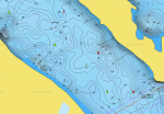
Here's a screenshot of the map for your area. The obstructions are noted:
Nav Map.png
 

sholum97

Recruit
Joined
Jul 13, 2017
Messages
4
Southkogs: That appears to be something that might work for me. Are the maps GPS enabled that will show my location on them?
 

southkogs

Moderator
Staff member
Joined
Jul 7, 2010
Messages
15,060
I did a write up on the app HERE

It is GPS enabled, and seems to work well. I don't thinks it's quite as accurate as my Garmin GPS units, but it's been sufficient for me. It gives you a couple of viewing options and will show your position.
 

Old Ironmaker

Captain
Joined
Dec 28, 2015
Messages
3,050
I did a write up on the app HERE

It is GPS enabled, and seems to work well. I don't thinks it's quite as accurate as my Garmin GPS units, but it's been sufficient for me. It gives you a couple of viewing options and will show your position.

Like I said the Garmin chip is more detailed than my Navionics Gold but that's not saying the Navionics isn't good, it is great. I don't know why anyone with a boat doesn't have a GPS/Combo unit. A shoal, rock, reef doesn't care how big or small your boat is. Nor does fog. They are like Flat Screen TV's, their cost is less and less every year.
 

JASinIL2006

Vice Admiral
Joined
Feb 10, 2012
Messages
5,738
The Navionics data looks pretty similar to what I get on my Garmin with the LakeMaster chip, although maybe a bet less detailed. It certainly looks good enough for boating on the river. If you're going to use a smartphone or tablet for navigation, consider how/where you will mount the device, how you will protect it from moisture and whether or not the screen is sufficiently bright for you to see the maps in bright sunlight.

For the Miss. River, I'm wondering what the data source is for the Navionics app? Do they use the Army Corps data, or do they have some other source?
 

southkogs

Moderator
Staff member
Joined
Jul 7, 2010
Messages
15,060
... I'm wondering what the data source is for the Navionics app? Do they use the Army Corps data, or do they have some other source?
They source from multiple channels, including Army Corp. Some is chart information derived from people using the app and charts themselves. You can read some HERE.
 
Top