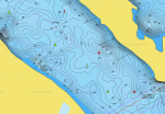
I'm looking for a bit of help. I just purchased a new Harris 22' pontoon with a 115hp Merc for crusing. The pontoon is slipped on the Mississippi River in the LaCrosse, Wisconsin area. For those of you that are unfamiliar with the upper Mississippi, there are an awful lot of underwater obstructions known as wing dams in the area. They are basically piles of cement/rock that are randomly placed just under the water for the purpose of pushing water towards the main channel. You're fine if you stay in the main channel but are rolling the dice if you venture off of it unless you know the river well.
To my question... Are there products out there that will show me the underwater obstructions while I am boating? I'm looking for an electronic screen that will basically tell me that a wing dam is 20' or whatever in front of me off to the left if that makes any sense. I don't fish and am unfamiliar with the technology out there. Do I need a GPS? Fish finder? Chart plotter? Something else??
Thanks for any help you can offer...


